Table of Contents
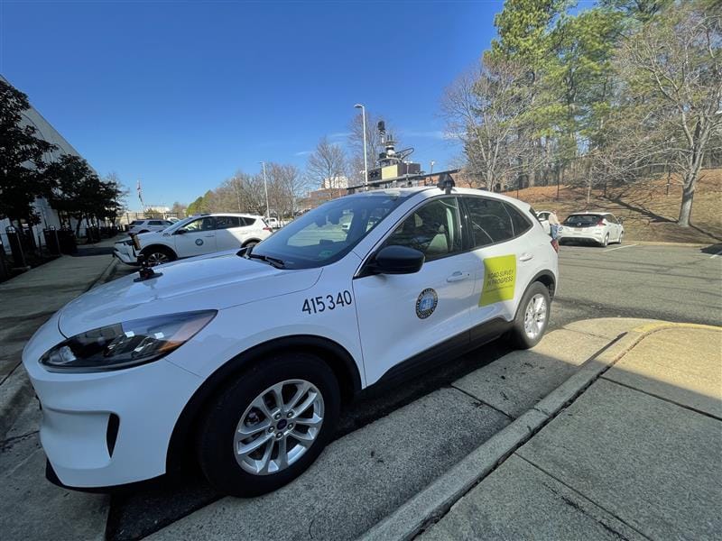
Starting Tuesday, Alexandria residents may spot an unusual City vehicle rolling through their neighborhoods — a white Ford SUV mounted with cameras and sensors designed to assess road conditions in real time.
The vehicle is part of the SMART Roadway Management Initiative, a collaborative pilot between the City of Alexandria and the Virginia Tech Transportation Institute (VTTI), funded through the U.S. Department of Transportation's SMART Grant Stage 1 program. Operations begin March 17.
Why now — and why this approach
Until now, the City's roadway condition data has been limited, relying largely on periodic inspections and resident reports. According to a SmartScan status presentation published on the project's webpage, commercial camera- and sensor-based tools have advanced enough to enable continuous, vehicle-based monitoring — though the City acknowledged those solutions vary in accuracy, reliability, and integration readiness. Phase 1 of SmartScan is designed to create a ground-truth evaluation to help guide any future expansion.
How the vehicle works
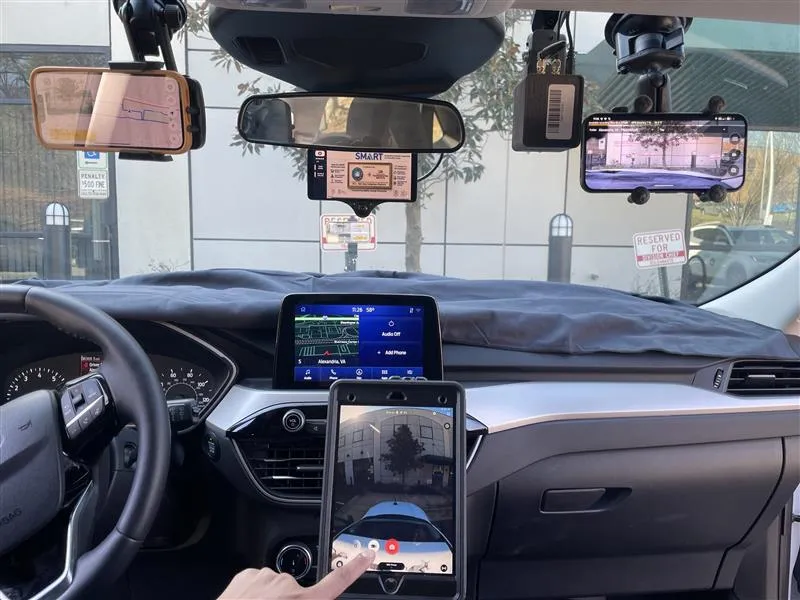
Cameras and sensors aboard the vehicle will collect real-time data on pavement condition, traffic signs, lane markings, and other transportation infrastructure. The City says the program is designed to "support proactive, data-driven maintenance and investment decisions, helping the City extend asset life, improve safety, and reduce costs," according to the project webpage.
The pilot will focus on two areas: the West End and Old Town Historic District. Collected data is set to feed into Cityworks, the City's existing operational platform, as part of an effort to integrate scanning technology into day-to-day maintenance workflows — building what the City describes as "a continuously updated inventory of infrastructure assets."
The vehicle will be operated by a licensed City staff member at all times and is not autonomous, despite carrying equipment that may resemble that found on self-driving cars, according to the City.
For residents with privacy concerns, the City says protections are built into the system. Faces, license plates, building interiors, and animals will be automatically blurred, per the project webpage.
A competitive process
The City did not move quickly to select vendors. According to the SmartScan status slide deck, the City issued a Call for Innovation through Marketplace.city — a procurement platform for local governments — and received 24 submissions. Staff conducted technical interviews with seven vendors before narrowing the field to four finalists.
Vendors were evaluated on technology maturity, data accuracy and reliability, asset coverage, system integration readiness, and data governance and cost. Key selection factors also included proven real-world performance, scalability, and clear City data ownership, the slide deck states.
The four selected vendors represent different scanning approaches: Vaisala and Vialytics are providing smartphone-based solutions, Cyvl is deploying a camera and LiDAR system, and RMT is contributing a camera and radar setup. VTTI is also using the Comma.AI system for ground truthing — a process used to verify the accuracy of collected data — per the project webpage.
In February, City staff from the Smart Mobility and Transportation Engineering teams worked with Fleet Management to install the hardware on the fleet vehicle ahead of deployment. The City says the technology will "help the City identify roadway issues faster and improve how streets are maintained and managed."
What comes next
This project officially launched in August 2025. Deployment and testing are scheduled through fiscal year 2027, followed by data analysis and reporting. Results from Phase 1 will be used to evaluate vendor performance and assess whether and how the technology could scale across Alexandria's broader transportation network, according to the SmartScan status slide deck.
More information, including the full SmartScan slide deck, is available on the project's webpage.


