Table of Contents
The city will present flood modeling results and gather public input on flooding impacts at a community meeting on Monday at Patrick Henry Recreation Center.
The 7 to 8:30 p.m. meeting will include findings from the Flood Resilience Plan, a community vulnerability assessment and resident survey feedback. The meeting will also be available via Zoom.
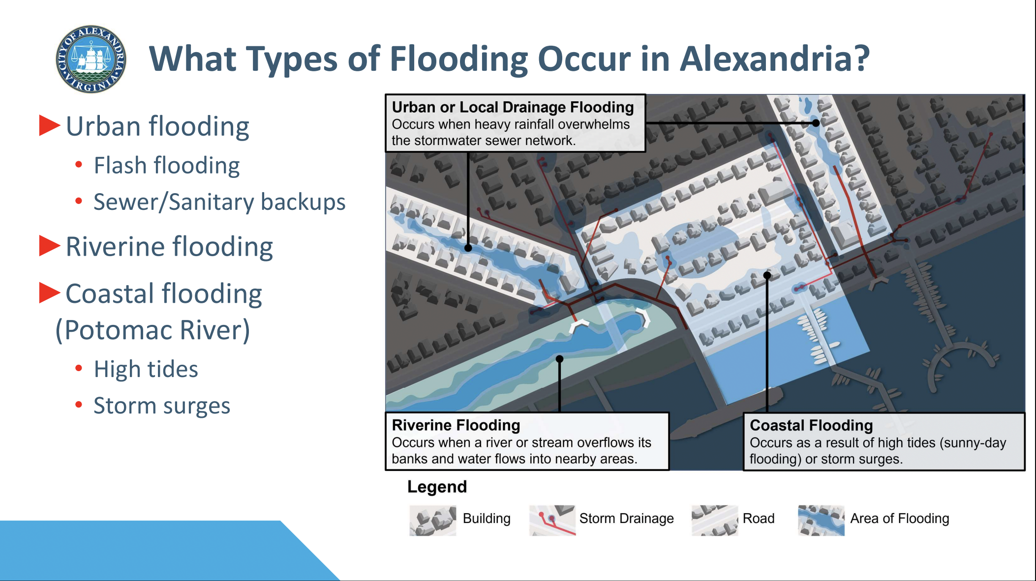
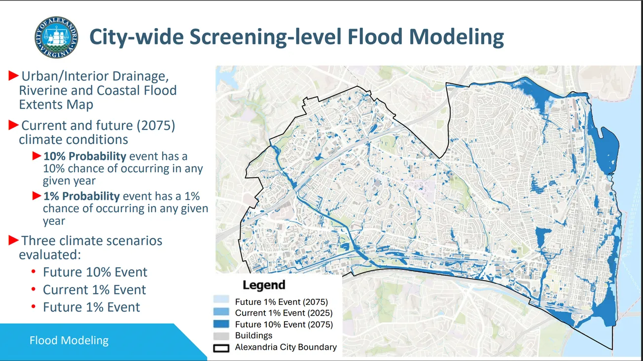
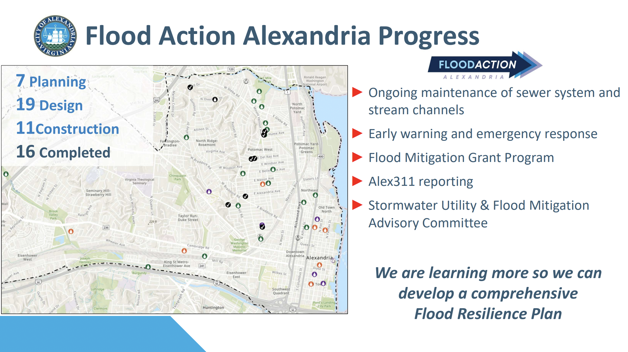
City flood modeling identifies urban flooding, including flash floods and sewer backups, riverine flooding from streams and rivers, and coastal flooding from the Potomac River caused by high tides and storm surges.
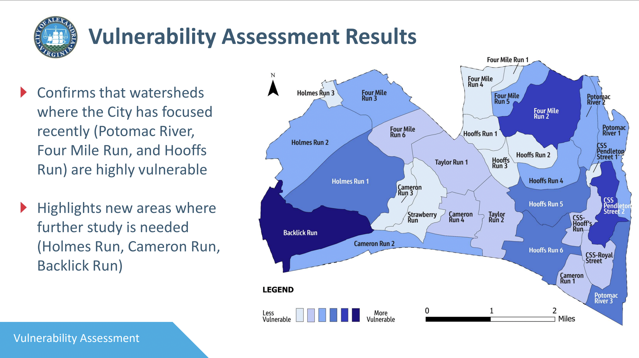
The vulnerability assessment confirms high flood risk in watersheds where the city has focused recent efforts — Potomac River, Four Mile Run, and Hooffs Run. It also highlights three areas needing further study: Holmes Run, Cameron Ru,n and Backlick Run.
The presentation shows flood modeling for current conditions and 2075 climate projections under three scenarios: a future 10% probability event, a current 1% probability event, and a future 1% probability event.
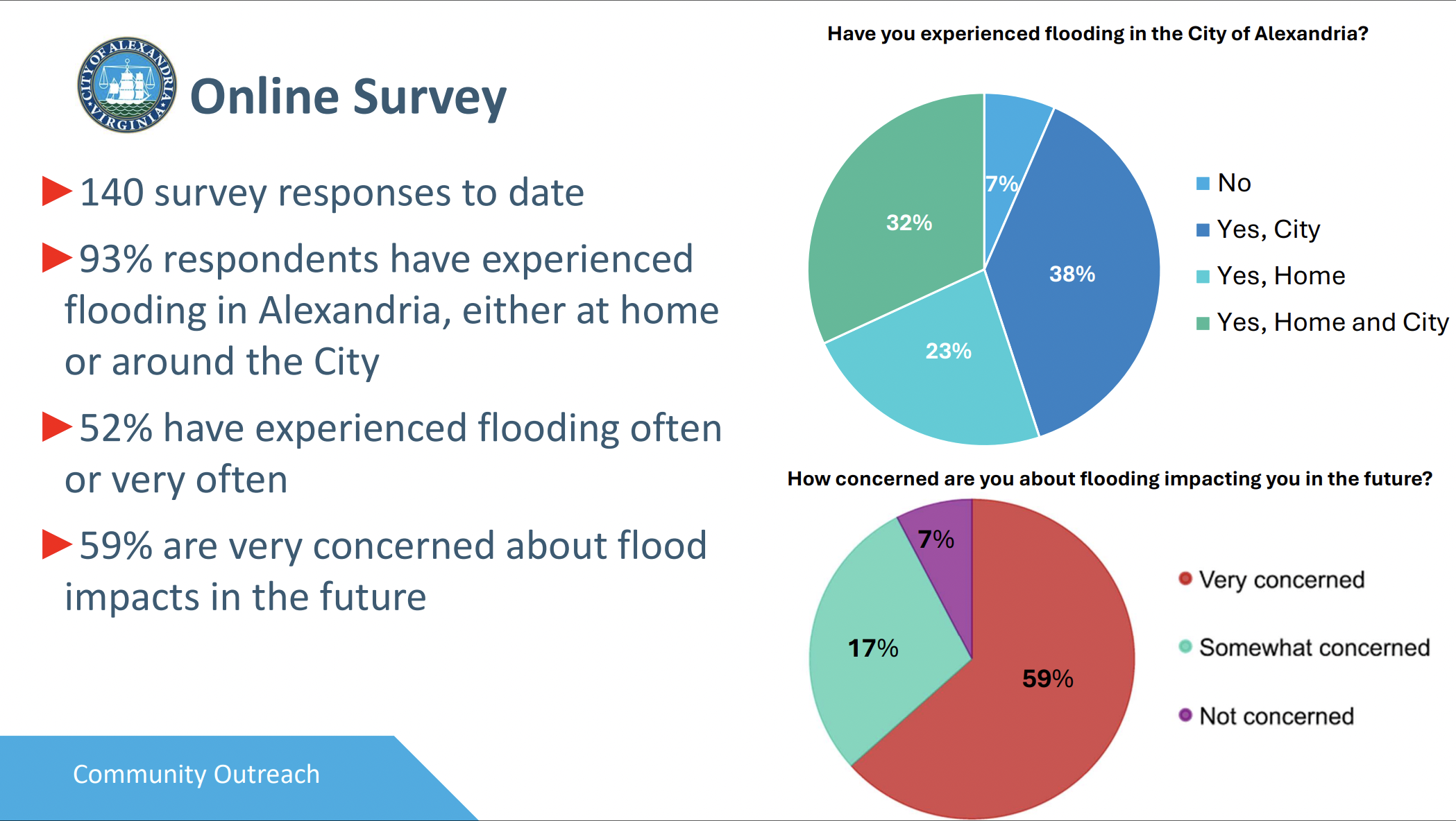
An online community survey has collected 140 responses, with 93% of respondents reporting flooding experiences in Alexandria. Fifty-two percent reported experiencing flooding often or very often. The survey has mapped 128 flood locations citywide and remains open through Nov. 30 at bit.ly/AlexCommunitySurvey.
The plan, funded by a Virginia Department of Conservation and Recreation grant, builds on the city’s Flood Action Alexandria initiative launched in 2021. It will identify flood hazards, prioritize mitigation projects, and develop strategies for flood risk reduction.
Next steps include developing a resilience strategy addressing mitigation solutions, equity, preparedness, policies, communications, and funding. A second community meeting is scheduled for early 2026, with the final plan due in June of that year.
The meeting will take place at the Patrick Henry Recreation Center, located at 4653 Taney Ave., and is accessible via the free DASH Bus Route 8W. Virtual attendees can join the meeting via Zoom using the meeting ID 955 076 843 09 and passcode 123456, or dial 1-301-715-8592.
A recording will be posted to the project webpage after the meeting.

