Table of Contents
ALEXANDRIA, Va. — The city will lead a community walking tour of the Taylor Run Infrastructure Stabilization Project from 3 to 5 p.m. Tuesday, Aug. 18, giving residents a chance to see the project area and question staff about the design now on the table.
Participants meet in the Chinquapin Park Recreation Center parking lot. The tour is part of the city's engagement as the project moves through design, and staff will discuss the approach to stabilizing infrastructure within Taylor Run and take questions on the 60% design set.
Separately, the city has extended its deadline for public comment on those plans. Feedback submitted through the project's online form is now due Sunday, Aug. 30, and will be reviewed as the design advances.
What the project is now
The project carries a $2,155,000 budget — $350,000 for design and $1,805,000 for construction — and is aimed at protecting sewer pipes, manholes, outfalls and trails, stabilizing streambanks near those assets, and limiting how much ground gets disturbed. The city lists preserving mature trees and wetlands among the project goals.
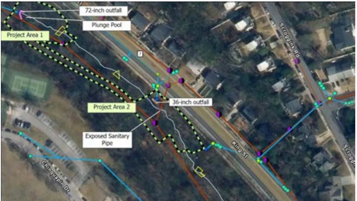
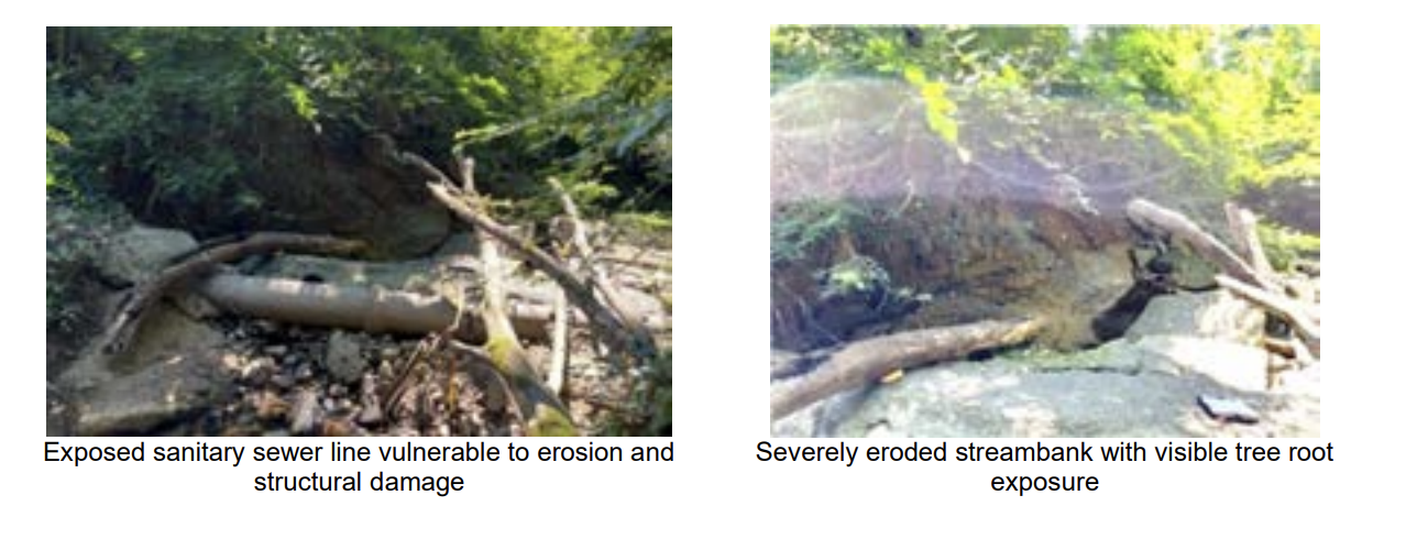
The stream runs near the Chinquapin Recreation Center and the King Street campus of Alexandria City High School. City stormwater chief Jesse Maines has said the exposed sewer lines need intervention to keep raw sewage out of the stream. The design includes encasing the lines, installing boulder cascades and constructing plunge pools, according to the Alexandria Times.
It is a much smaller undertaking than what the city proposed six years ago — by design, and after a long fight.
How it got here
In 2019, Alexandria secured state grants through the Department of Environmental Quality aimed at reducing pollution flowing to the Chesapeake Bay, including up to $2.26 million for Taylor Run.
The city then proposed reconfiguring roughly 1,900 feet of the stream using a natural channel design, work that would have removed more than 261 trees. The plan drew sustained opposition from environmental groups and residents, including the Audubon Society of Northern Virginia, with critics arguing the city had overestimated pollutant levels by relying on modeling rather than sampling the stream itself.
City Council halted the project in 2021 and sent it back for study. What followed was a consensus-building process facilitated by the University of Virginia's Institute for Engagement and Negotiation, bringing residents and staff together over roughly two years.
In June 2023, the council voted unanimously to abandon the full stream restoration and pursue a minimal intervention approach limited to stabilizing the sewer infrastructure. The city later returned about $3 million in state grant money tied to the original Taylor Run and Strawberry Run projects, and both were removed from the city's Chesapeake Bay action plan.
The current design reflects that mandate. Brandon Alderman, a senior stream restoration designer with the engineering firm AECOM, told the Alexandria Times after the July briefing that the minimal intervention approach limited what the team could do, and that the design has come to about the lowest point that still produces something buildable.
Twenty-five living trees
Trees were the flashpoint in 2020, when the earlier proposal would have taken more than 261 of them. The current design puts the number at 25.
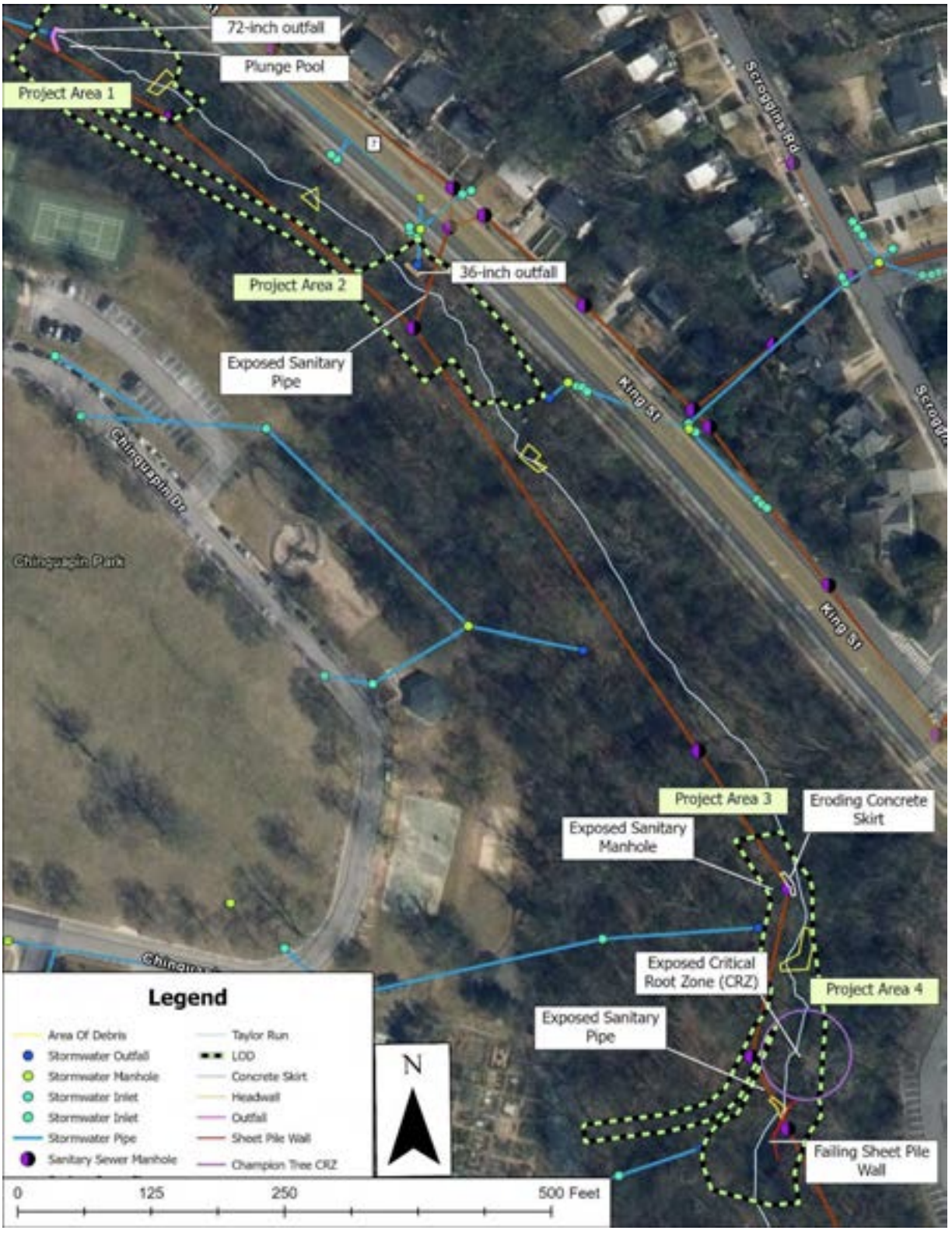
The Basis of Design Report tallies the impact by project area: 18 living trees in Project Area 1 at the upstream outfall, two in Project Area 2, and five across Project Areas 3 and 4. In Area 1, the report notes, many trees have already died and fallen from bank erosion or storm damage, so little clearing is required. The project will not cut new paths for construction access, using existing park trails and King Street instead.
AECOM updated the tree inventory in field work between May and July 2025, documenting 749 trees — 629 living and 120 dead — across more than 40 species. Red maple was the most common at 152, followed by tulip poplar at 123, black locust at 80 and slippery elm at 54. Black locust had a mortality rate of about 32.5%. Another 63 trees were too deteriorated to identify, all of them dead, and the report suggests the city look at whether removing them would make the park safer.
The plan set marks the trees the Consensus Building Group asked to keep: a note states that trees listed in bold in the tree table "were designated by the Consensus Building Group (CBG) as trees to preserve," with their labels underlined on the plan view. Before construction, the limits of disturbance are to be walked by the consultant Wetland Studies and Solutions Inc., the contractor and the city arborist to confirm removals, and the contractor can flag a tree it believes could be saved.
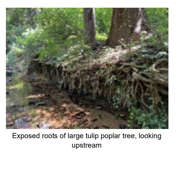
One tree gets its own engineering. A large tulip poplar in Project Area 4 has had its root mass exposed by bank erosion and is at risk of falling. The design calls for rock packing through its critical root zone and boulders set at the toe of the bank beneath it.
What the design calls for
The work covers 589 feet of stream, split across four non-continuous areas — 129 feet, 130 feet, 70 feet and 260 feet — within a corridor of roughly 1,500 feet.
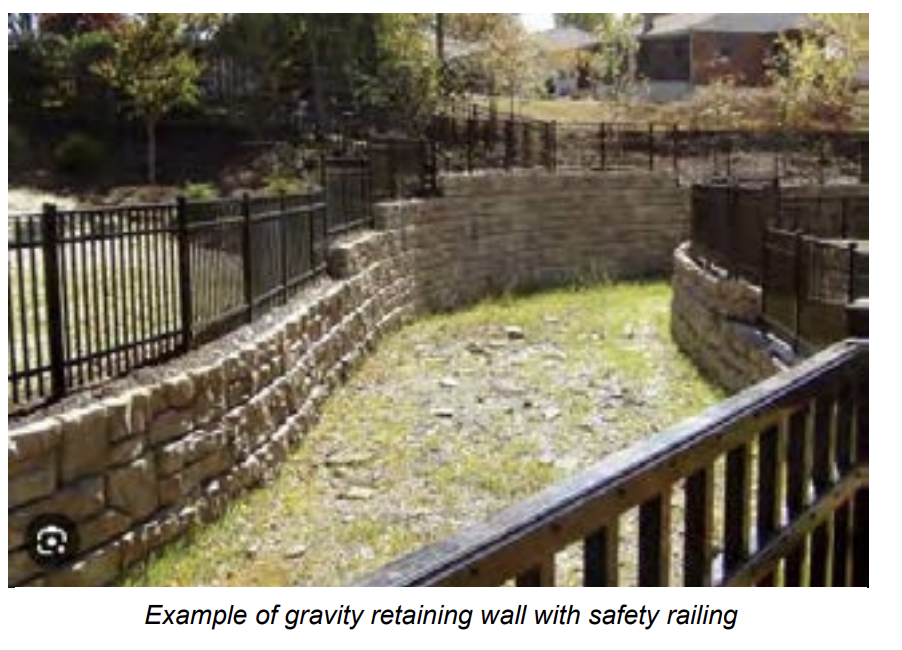
Gravity walls with a rock facade will stabilize the banks in all four areas. Because of the high school next door and heavy park use, the walls will be vertical to discourage climbing and sitting, with railings along the top to prevent falls. In Project Area 2 they reach 15 feet. The walls carry one foot of freeboard above the projected 100-year water surface, short of the three feet FEMA would require for an accredited flood wall — a choice the report says allows shorter walls and lower costs.
Both exposed sanitary sewer pipes will be encased in concrete. Two deteriorated stormwater outfall structures will be replaced. Three boulder cascades will step the streambed down, and the plunge pool below the 72-inch outfall will be rebuilt.
The hydraulic modeling projects the 100-year water surface will rise an average of 0.7 feet across the project reach, with a maximum of 2.85 feet just upstream of Project Area 4. The report states that rise sits entirely on city property and does not affect adjoining properties.
The engineer's cost estimate is $1,794,401, including a 20% contingency and a 4.3% inflation factor based on a construction midpoint of February 2027. State wildlife rules bar in-stream work from March 1 to June 30 to protect cold-water species.
What's ahead
The 60% plans were delivered to the city in July and presented at a community meeting July 20, after a delay from May. It is the third round of public review — the city held a 30% design meeting in November 2025, a site walk that December and a separate meeting on one of the outfalls in March.
Design work runs through September, with construction scheduled from October 2026 through December 2027. The city notes that phase begins with hiring a contractor, and that visible site activity typically starts a few months after that.
The city is asking that comments focus on the elements currently being designed. The 60% Basis of Design Report runs 648 pages with its appendices, which include a tree inventory, a wetland delineation, a geotechnical assessment, hydrology and hydraulics modeling and a cost estimate. The 60% design plans are posted separately, along with the July presentation slides and a recording of that meeting.